Taishaku-kyo Gorge
This beautiful 15km long canyon in the northeast of Hiroshima prefecture has many natural features and is a popular place to enjoy the autumn colors.
In terms of visitor attractions, Taishaku-kyo has two main areas, upper and lower Taishaku, divided by steep mountain pass. To the north (upper Taishaku or kami-taishaku) is a 2.5km well-maintained promenade which starts at Eimyo-ji Temple.
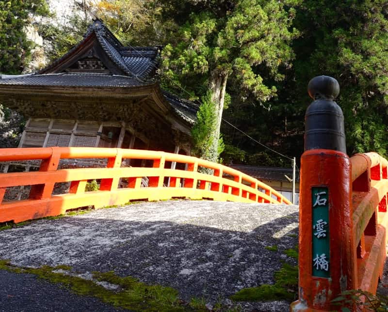
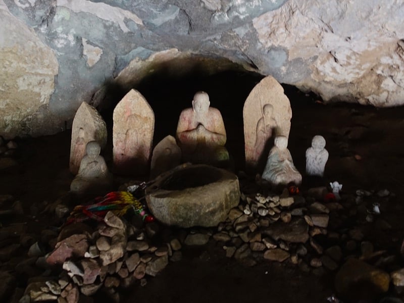
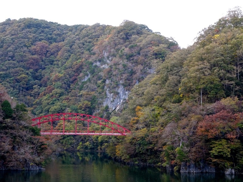
This temple dates from the 8th century and is dedicated to Taishaku-ten (or Indra as this Buddhist deity is known in Hindu) from which the gorge get’s its name. It is situated at the base off the precipitous Mt Sekiun next to the Sekiun Bridge picturesque red bridge. Behind the temple is a Sai-no-kawara or ‘Children’s Limbo’ which can be accessed via from the road which to which the red bridge crosses. Sai-no-kawara is, according to legend, a riverbed in the netherworld to which the souls of children who have died prematurely are sent as punishment for the sorrow they have caused their parents. They hope to attain salvation by making the pillars of stones characteristic of these locations.
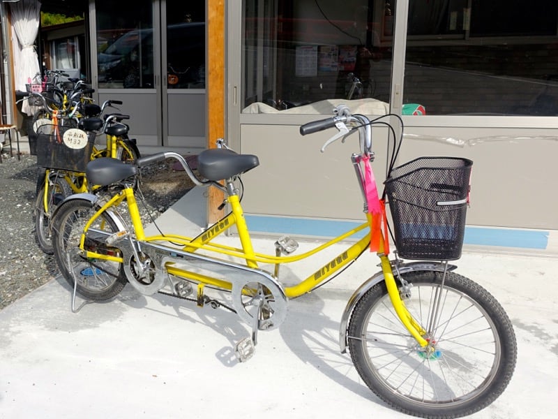
Between here and the start of the promenade proper are two places where you can rent bicycles for a very reasonable ¥500 between here. These include standard mama-chari shopping bikes (some with child seats), bikes for kids and, at the place next to the parking lot in front of Eimyo-ji Temple, fun-looking tandems).
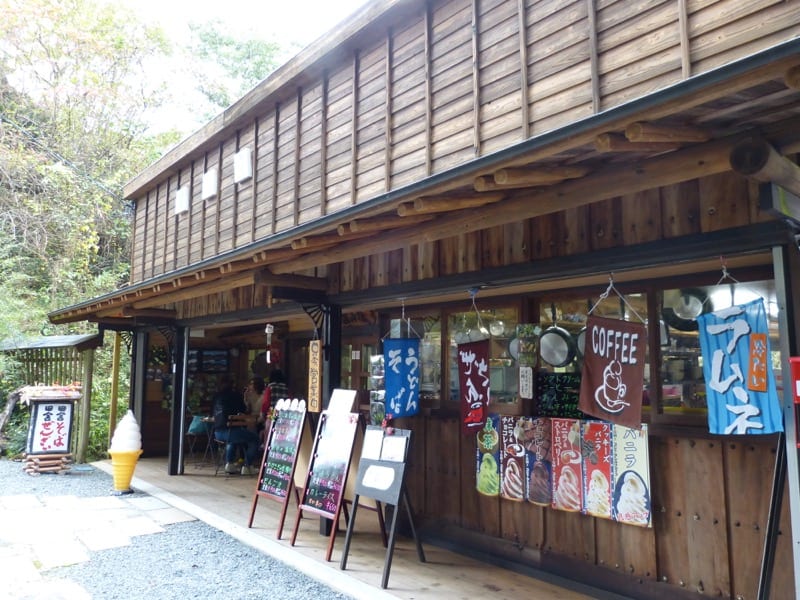
The rental place next to the second parking lot is attached to a casual restaurant and there is a fishing ponds behind. Just before the starts there is another place you can eat called Keizanso [渓山荘] staffed by some lovely ladies who are very welcoming and friendly.
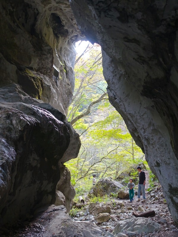
Once onto the trail that follows the beautiful Taishaku River, it is only 800m to the Hakuun-do Caves. The entrance to the cave is up a steep set of steps on the left side of the path. It’s only ¥250 for adults to enter the caves and, with signs saying you it would take about 10-15 minutes to see the cave, my son and I were prepared to be unimpressed. The caves actually turned out to be one of the best parts of a great day and we would highly recommend them.
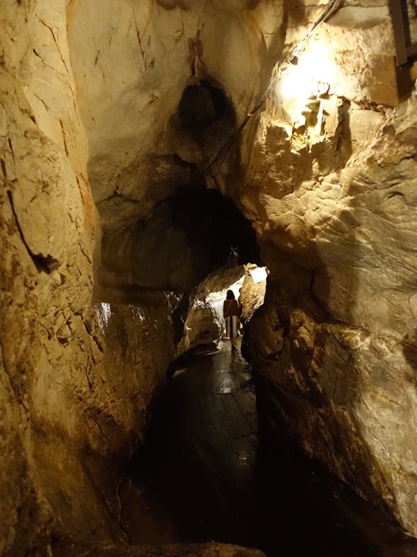
The 200m long limestone caves, carved out by underground water flows over thousands of years, are full of interesting rock formations which have some great names (most labeled in English as well as Japanese). If you are in claustrophobic, however, I would think twice as parts of the route are very narrow and visitors have to make their way in and out along the same route, so things can get quite “cozy”.
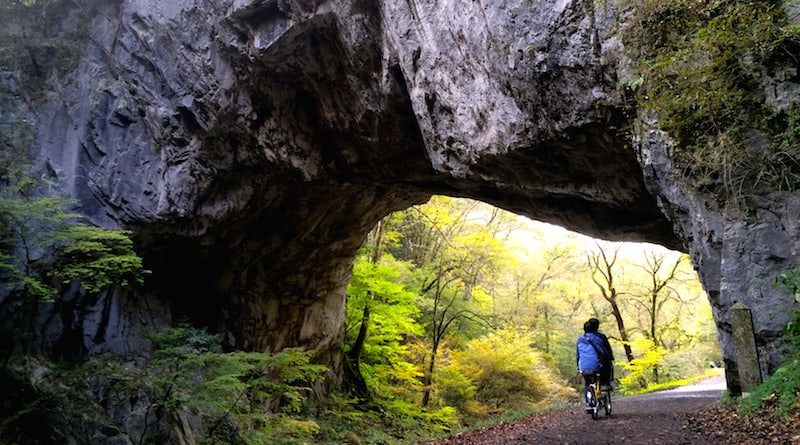
A very short walk from the caves is the Karamon Gate (though if you are trying to entertain kids, perhaps tell them it’s other name, Oni-no-mon or ‘Demon’s Gate’). Slightly off the main path up a slight incline, Karamon is a high natural stone arch.
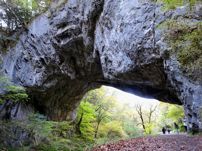
This part of the Taishaku Valley, however, is best known for the Onbashi natural limestone bridge about 1km further along the path and this is where most of the visitors are aiming for. On-bashi means ‘male bridge’ and, reportedly one of the world’s three largest natural bridges, spans 90m over the river at a height of 18m. It really is very impressive.
Most visitors turn back once they have marveled at, and photographed, Onbashi, but the trail continues past the Dangyo-kei Rapids and the Somen-daki waterfall which is a further kilometer or so along the river. A roundtrip walk from the the trailhead to the waterfall is about 6km.
Onbashi’s female counterpart, the Menbashi Bridge, can no longer be seen as it was submerged when the river was dammed further downstream almost a century ago. The dam created Shinryuko ‘Divine Dragon’ Lake which is 8km in length and 24km all the way around.
There is a trail that links the northern part of the valley with Shinryu-ko Lake (the Chugoku Nature Trail leaves the valley promenade at a bridge between Dangyo-kei rapids and Somen-daki Falls), but it is a steep climb and hikers are advised to give themselves 2 hours or more to make the trip.
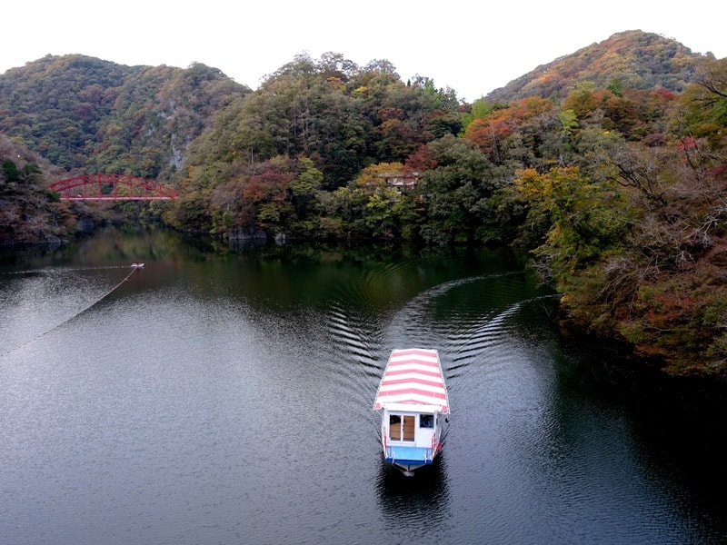
Pleasure cruises which allow you to view the southern end of the lake leave from a launch station below the Koyo-bashi Bridge every thirty minutes from 09:00 to 16:30. You’ll also find and information center and some places to eat here.
Access:
Sanyo Expressway
Get off at Fukuyama-higashi [福山東] IC from where it is 55km along Route 182 to Tojo [東城]
For Upper Taishaku [上帝釈] take Route 314 followed by Route 23 towards Shobara [庄原] and Taishaku [帝釈] (12km)
For Shinryko Lake [神龍湖] take Route 25 towards Mihara [三原] and Joge [上下] (10km)
Chugoku Expressway
Get off at Tojo [東城] IC
For Upper Taishaku [上帝釈] take Route 314 followed by Route 23 towards Shobara [庄原] and Taishaku [帝釈] (12km)
For Shinryko Lake [神龍湖] take Route 25 towards Mihara [三原] and Joge [上下] (10km)
Train and bus
It is possible to get to Taishaku-kyo by public transport if you are motivated.
4 buses a day run from Tojo JR Station run to Upper Taishaku [上帝釈方面] (25min) and to Shinryuko Lake [神龍湖方面](15min) though please be aware that the Upper Taishaku bus does not run on weekends and national holidays.
Taishaku-kyo Tourism Association: 08477-2-0525