Hiking Sandankyo Gorge
Sandankyo Gorge may only be 90 minutes from Hiroshima, but it is a world away from the hustle and bustle of the city and one of the area’s best hiking spots.
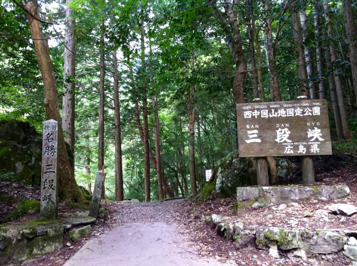
The entrance to this beautiful gorge may only be an 90 minute bus ride from the city center, but once between its sheer cliffs, surrounded by verdant vegetation and hearing the rush of the crystal clear water over rocks it’s easy to grasp that very few people had ever penetrated Sandankyo Gorge until a little over a century ago. What is more difficult to understand is why, other than for a few short weeks between late October and early November when large numbers of leaf watchers make the trip to see its famous Autumn colors, Sandankyo Gorge is rarely overrun. All the better for those want to escape the hassles of city for a day and love to stroll among nature.
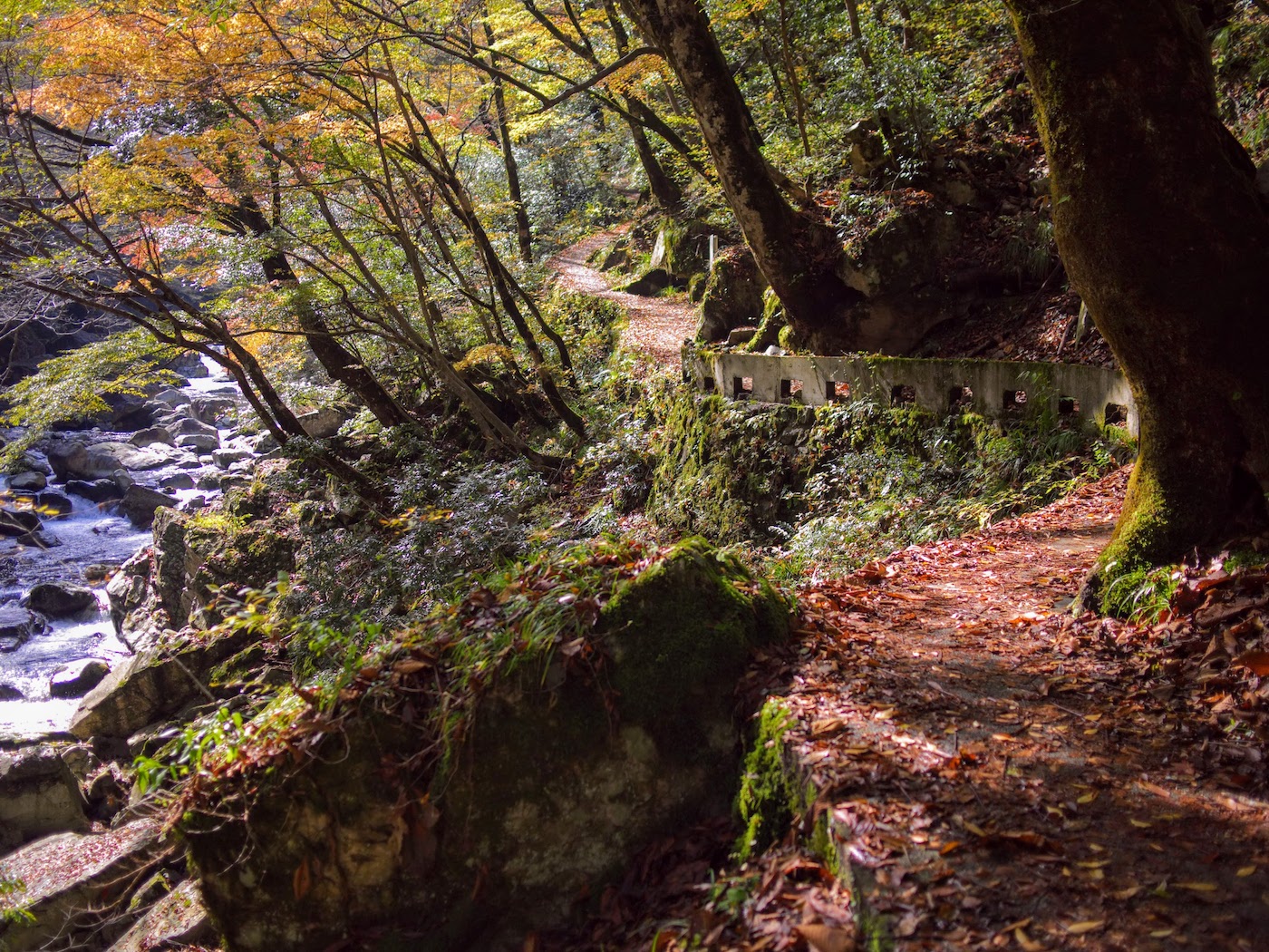
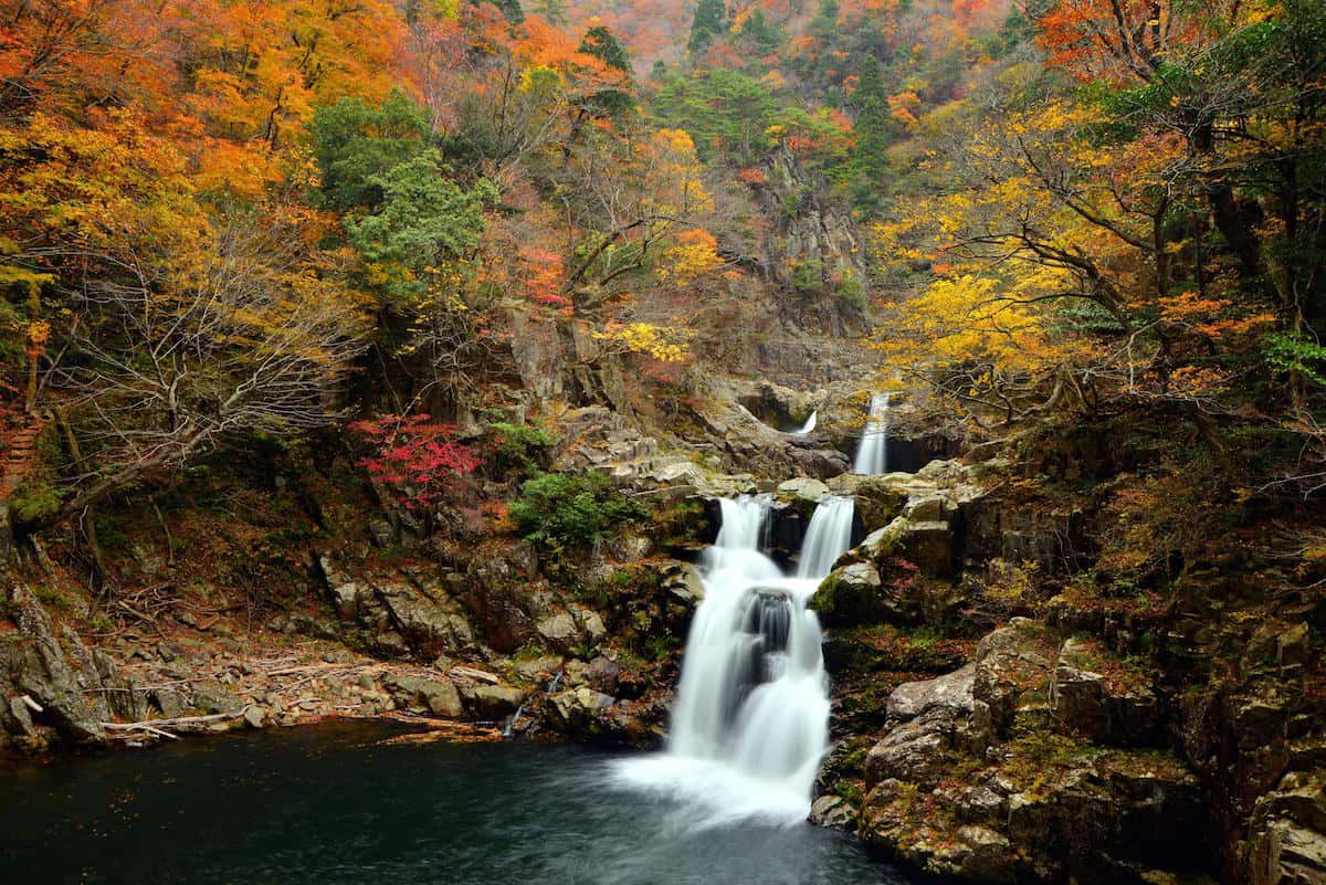
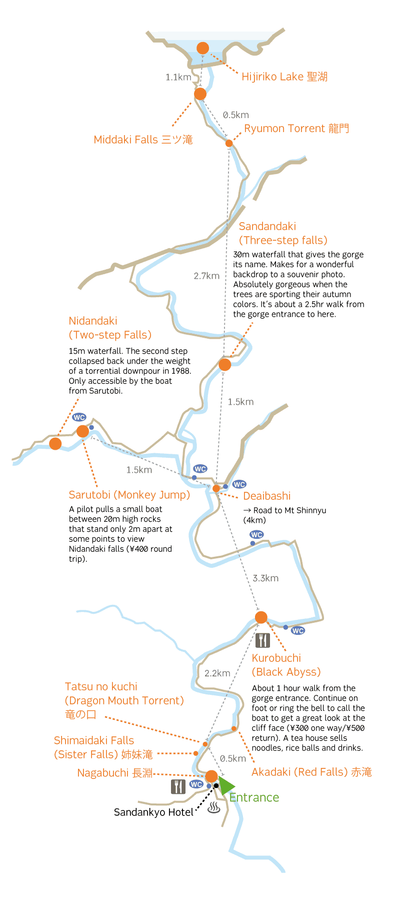
Sandankyo makes for a wonderful hike. The out-and-back trail (much of it surfaced with rough concrete) is very clear and it is very difficult to get lost. Although the path does undulate, is very doable for anyone of reasonable fitness. The prime goal for many is Sandan-daki – the three tier waterfall for which the gorge is named – which makes the hike a full day commitment. Many of the trail’s highlights, however, can be seen on a walk as far as Kurobuchi (about 50 min each way).
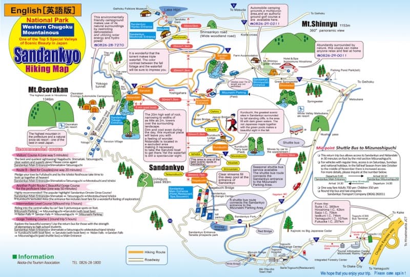
[Scroll down or click here for the trail map]
At the entrance to the gorge, there are a few small shops (which serve some food and will hold onto baggage for a small fee).
The bathroom where the bus drops you off, while not the only one on the trail, is certainly the nicest.
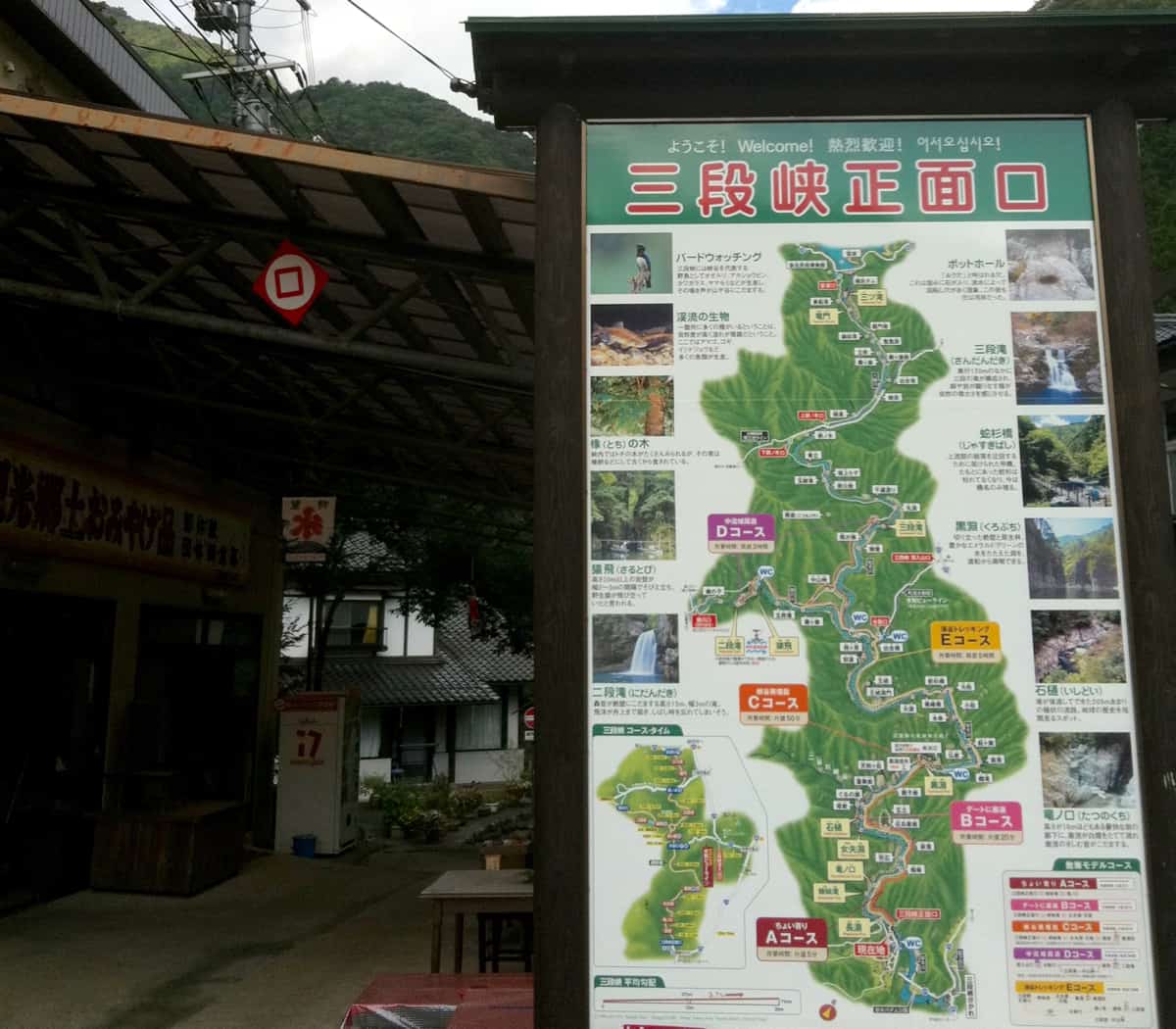
Time guide
Entrance to Kurobuchi 50min one way (3.7km) Entrance to Sandandaki via Sarutobi & Nidandaki 5hrs round trip (approx 19km) If you manage to catch one of the buses that run between the gorge entrance and the parking near Deaibashi it should take about 2hrs to loop Sandandaki,Sarutobi, Nidandaki and back.
The whole 12km trail from gorge entrance to Hijiriko Lake can take up to 5hrs one way. Access Buses to Sandankyo leave from Hiroshima Bus Center (Platform #7).
Express buses (¥1440 one way) take about 80min while local buses (¥1230 one way) take well over 2hrs. The 08:18 express bus arrives at the gorge at 09:33 and the 15:00 departure from Sandankyo will get you back at 16:20 (after that local buses leave at 15:30, 16:30 and 17:55).
For an early start the 06:10 local bus from Hiroshima will get you to the gorge just before 08:30. 19:10 is the last departure from Sandankyo taking you as far as Kabe JR Station from where local trains depart for Hiroshima.