Peace Pagoda Hike
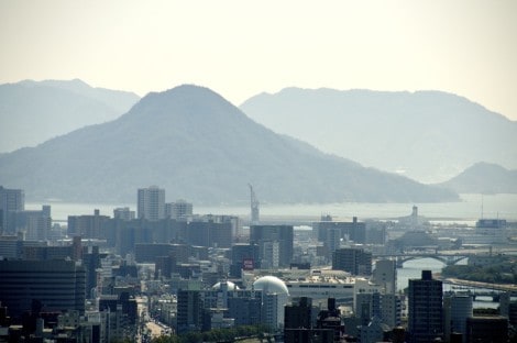
The trail up to the Peace Pagoda on Mt Futaba (139m) starts just a few hundred meters from Hiroshima Shinkansen Station, takes you through primordial forest, a tunnel of torii gates and rewards you with great views over the city of water and out over the Inland Sea.
Route:
Hiroshima Station – Tōshō-gū Shrine – Kinkō Inari Shrine – Peace Pagoda (139m)
Difficulty Moderate but steep with some uneven steps
Distance: Approx 2km
Time: 40m-60min
View Peace Pagoda Hike in a larger map
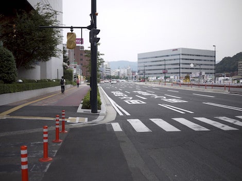
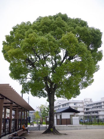
Getting to the trail is pretty easy. Start at the North Exit [kita-guchi] of Hiroshima Station (the mountainside – if you can see streetcars, you are on the south side and should take the underpass through to the other side!) With the station building at your back, head west (left) along busy Futaba-Dori in front of the station, alongside the Hotel Granvia Hiroshima. Look to up to your right and you should be able to see the silver Peace Pagoda on top of Futaba-yama. That’s where we will end up.
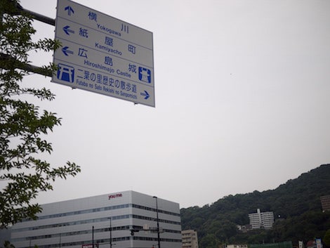
Just before you come to a busy intersection after about 250m with some vending machines on your left, there is a road sign with directions to Yokogawa (straight ahead), Kamiya-cho and Hiroshima Castle (to the left) and Futaba-no-sato-rekishi-no-sanpo-michi (to the right) written in English. It is the latter that we want, so cross Futaba-dori here, and walk straight towards the mountain.
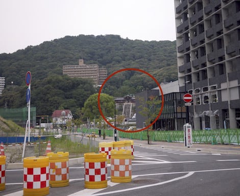
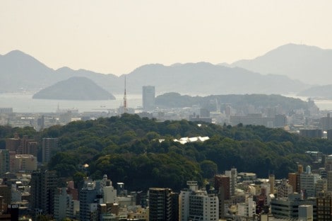
At time of writing, the steps up to Tōshō-gū Shrine are visible in the distance as you can see below. The construction going on in the area may change that, but just head down this road as far as you can san you’ll see the shrine. Incidentally, until destroyed by the A-bomb, this stretch used to be lined with cherry trees. A citizen group is campaigning to have at least some sakura planted on this stretch.
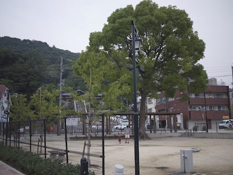
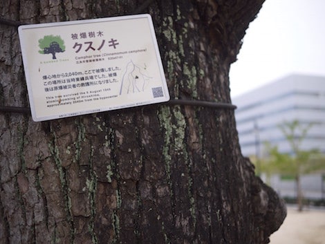
On the corner at the end of this road is a Shiribuka Park (named for some quite rare trees found in the forest on Futaba-yama). It isn’t much of a park, but it contains a single huge kusunoki tree (Camphor) which survived the A-bombing. I always try to lay my hands on it before heading up the mountain. There is also a restroom here.
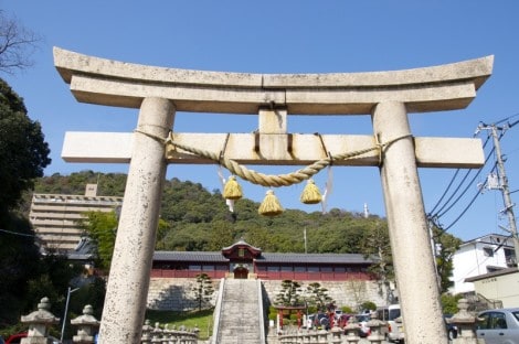
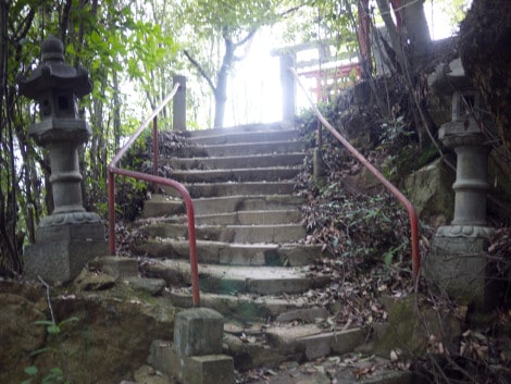
Tōshō-gū shrine is right across the street from the park. Pass under the large stone torii gate and make your way up the steep stone steps. If you would prefer, there is a small road which takes up around the side and behind the shrine.
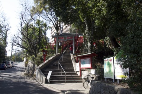
At the top of the stairs, pass through the decorated gate. The main shrine is directly in front of you. Make your way to the right and exit the shrine through the gate out on to the road. Take an immediate left and walk up the steep road. As it bends to the left, just up ahead you will see the steps up to Kinkō Inari Shrine on the right.
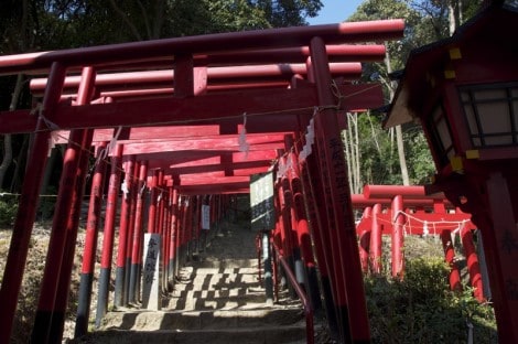
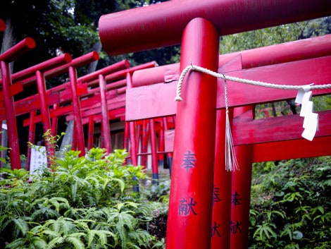
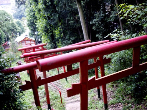
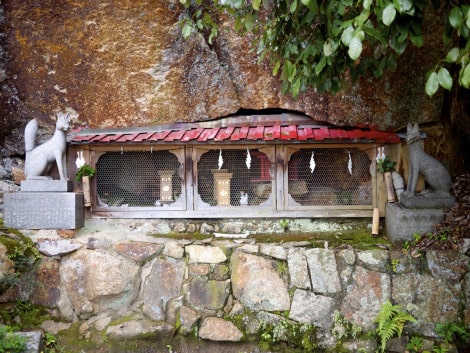
Kinko-inari is Hiroshima’s answer to Fushimi-inari in Kyoto. It is said that 100 red torii shrine gates lead to the inner shrine near the top of the mountain. By my count, you pass under about 75 on the main path. Not as impressive as Fushimi perhaps, but the bright red of the gates contrasted with the deep green of the forest is lovely and you don’t have to worry about crowds. Make your way up the stone steps and you will see the start of the mountain trail to the right of the brightly colored main shrine building; you can’t miss the tunnel of vermilion torii gates meander up the hill. Along the path there are many small shrines containing ceramic foxes, the animal closely associated with the Inari, stone jizo and even plain rocks.
 ]
] 
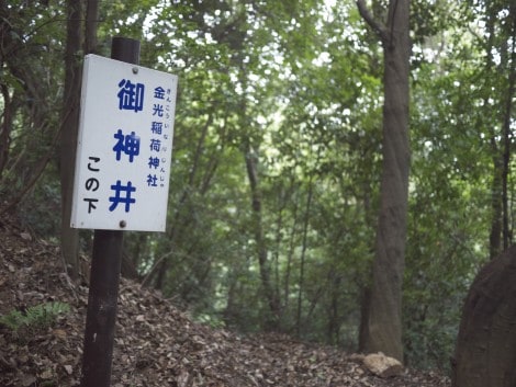
After the torii gates peter out you will see a white sign with blue Japanese characters which points to a side trail that goes off to the right. This leads to a kami-mizu [神水] sacred water source.
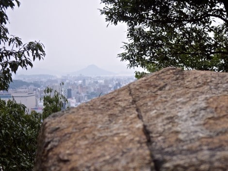
Continuing on up the hill, you will soon see some large rocks and stone steps heading off to the left. These lead up to the Oku-no-in inner shrine buildings. It is worth taking a detour here, as there are more little shrines dotted among the rocks and pretty good views from a vantage point on the rocks just above the shrine building.
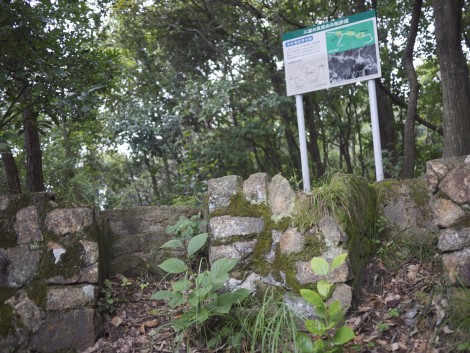
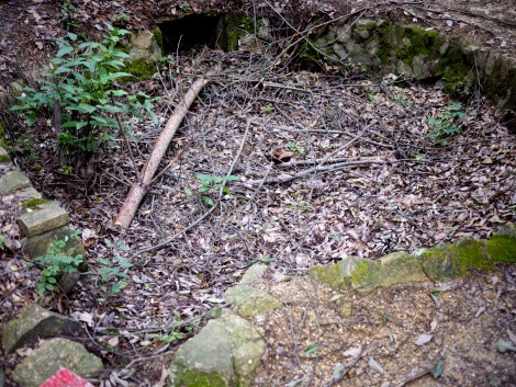
Continue up this steep rocky path for a few more meters and you come upon the ruins of several World War II gun batteries, now little more than holes in the ground, having been destroyed by the A-bomb blast from 2km away.
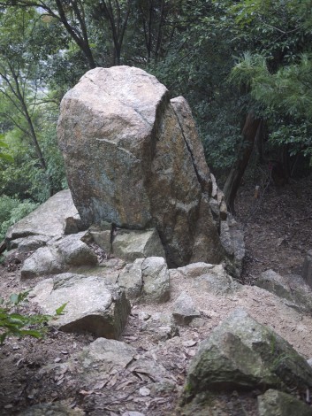
Follow the trail west (left with your back to the sea) and you come to Taiyo-no-iwa (Rock of the sun) and can continue down towards Nigitsu Shrine. Go east (right) and you’ll join the broad path mentioned below.
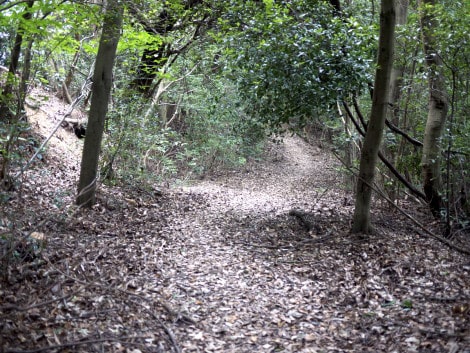
If you returning back down through Oku-no-in and to the main trail, after picking your way over some more large rocks and exposed tree roots you come out at a fairly flat trail. From the gun battery remains, with your back to the city and the sea (ie the way you came) head right and you’ll join this broad path. Head to the right along the broad path and you should soon see the silver metal of the pagoda glistening through the trees.
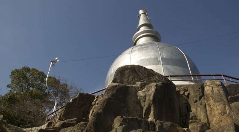
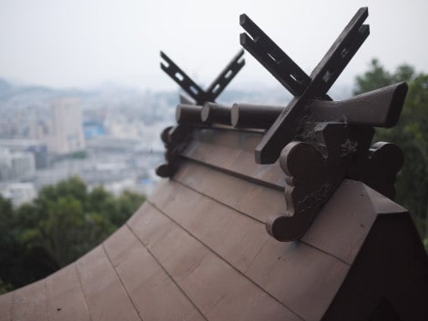
A quick hop up the final steps and you are at the pagoda.
After enjoying the view and perhaps scrambling over the rocks, it’s time to eat! Make your way through the open space (a popular picnic spot during the cherry blossom season) behind the pagoda and down the steep steps, at the bottom of which are some rather rudimentary porta-potties.
From here you head down the very steep road. As it bends sharply to the right, look for another trail shooting off to the left. Take this trail (you’ll see a small nondescript shrine on the right which seems to be a favorite spot for feeding stray cats) and follow it down for about 100m where you come to some steep steps that go down to a small residential area.
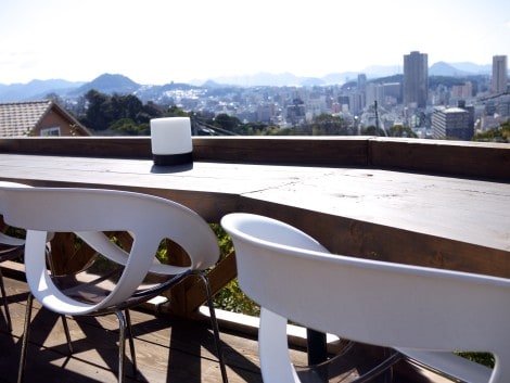
Make your way down the steps and past the houses, you pass a small park on the right before the road dips down to left, bringing you to a 5 way intersection. Look to the right and you’ll see the sign and parking lot for the MAHOGANY Steak & Coffee restaurant – a good place for a refreshing drink with great views. Unfotunately MAHOGANY is now closed, bulldozed (along with its beautiful sakura trees) and is now a parking lot.
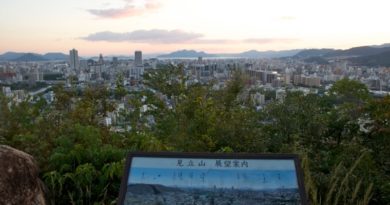
To get back, you can either retrace your steps over the mountain, or return more directly via the road the runs below MAHOGANY. It is quite steep and you need to be careful of traffic. Alternatively, you can call local cab company Tsubame Kōtsū on 082-221-1955. It’s about a 5 minute ride back to Hiroshima Station. If you’ve still got a yen for more trail, you can join the 7km Ushita Alps” trail, a crescent-shaped undulating trail that takes you over 231m Ushita-yama, to the Mitate-yama outlook and down to the Ushita (Big Wave) Astram Line Station. From here, you can hop on a train to the city center, or cross over to the river on the other side of the tracks and take the traffic-free riverside path that goes all the way to Peace Memorial Park.